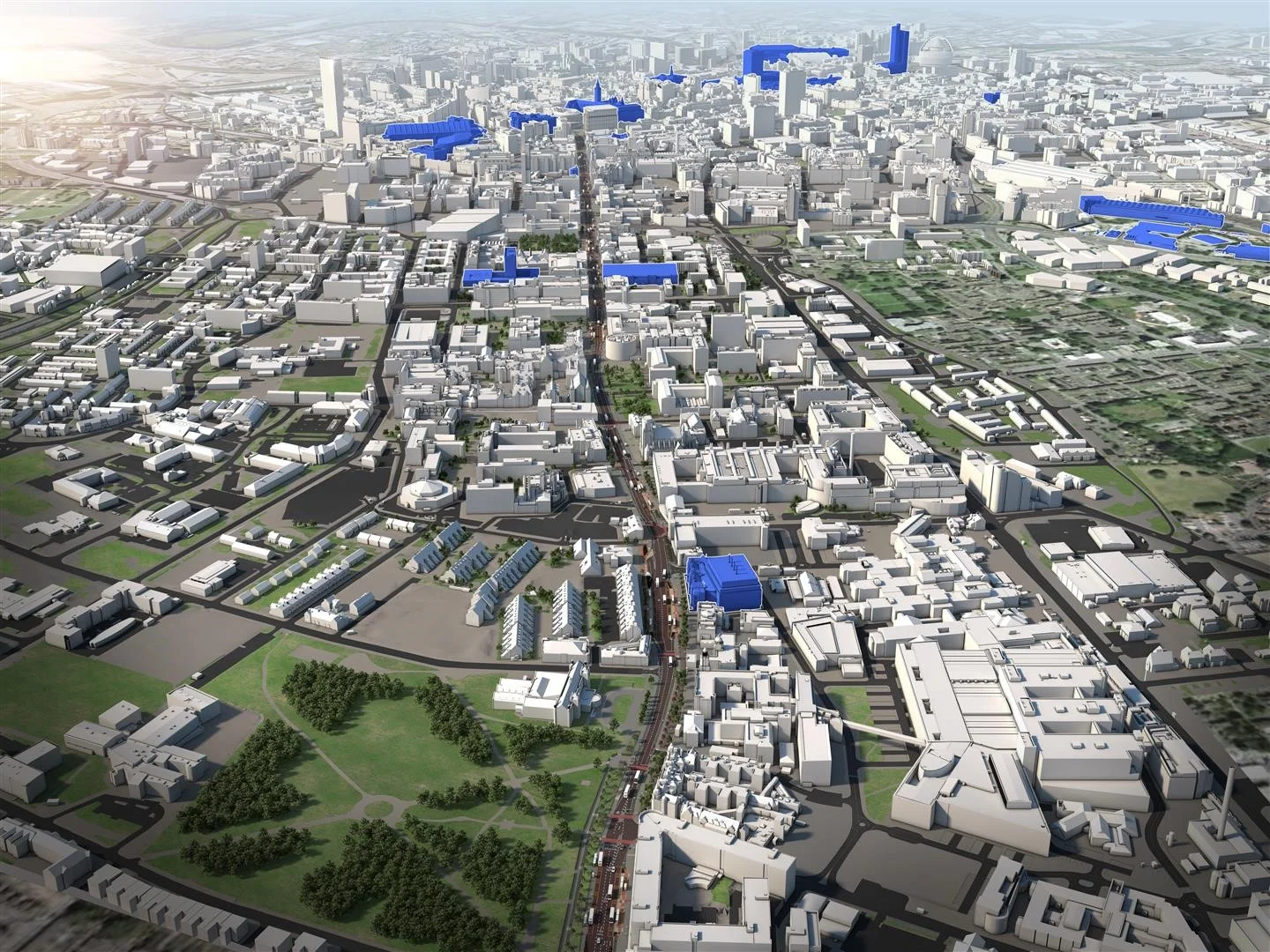
The Manchester Digital Model, established by Simon Mabey in 1996.
Local Authorities (LA’s) have an ongoing need to attract businesses, encourage development and engage with the public, civic societies and committee members as part of both planning and the process in sustaining their own town or city.
Our Approach
Is to establish open accessible urban 3D data (3D models or ‘digital twins’) which can support a wide range of applications, facilitating a more collaborative urban design process and providing software which helps you to engage with stakeholders. We also develop virtual reality experiences and public engagement events that can play an important role in engaging the widest possible demographic with consultations, including those traditionally under-represented.
“There is so much talk in the media about VR/AR, AI and robots but rarely does the general public get to experience it and the affordances it can offer, it often feels like hype to us all.
Simon Mabey is one of the few creative technologists bringing it to life for everyone, and his application of the technology to nature, has so much potential to engage people in the benefits, opportunities and challenges ahead.
This of course a glimpse at what can be illustrated, we need to garner such creative technology to illustrate how people living in cities can restore their health, that of their children and the planet by turning the nature and horticulture to develop, healthy, liveable and resilient places”
Our applications and services include:
Realtime interactive software enabling users to walk or fly around the 3D urban models without the need for any specialist software or training
Touch screen / interactive information displays to support marketing and promotional activities.
The design of virtual reality (VR) immersive projects and public engagement events including the provision of VR headsets and professional staffing. This enables 3D models to be used to support the public consultation phase of development projects and a fun way to engage both existing and traditionally under-represented audiences.
Simulations integrating data from:
Traffic data, including microsimulation models
Dynamic hydrograph data from flood models
Spatial referenced mapping data including noise maps
Emissions data
Lighting studies, both calibrated simulations or luminescence false colour maps
Web based 2D and 3D integrated with GIS systems
Consultation and feedback applications
Information Management systems utilising both 2D and 3D environments as an interface

The many applications of the Manchester City 3D Urban Model.